SUNNYVALE → 5959 WESTERN PARK DR · BALTIMORE

The great
west-to-east run.

Seven photography-first days. One driver. US‑50, a truly dark Great Basin sky, red rock, big geometry—and no Washington detour.

Explore the route Best window · May–October
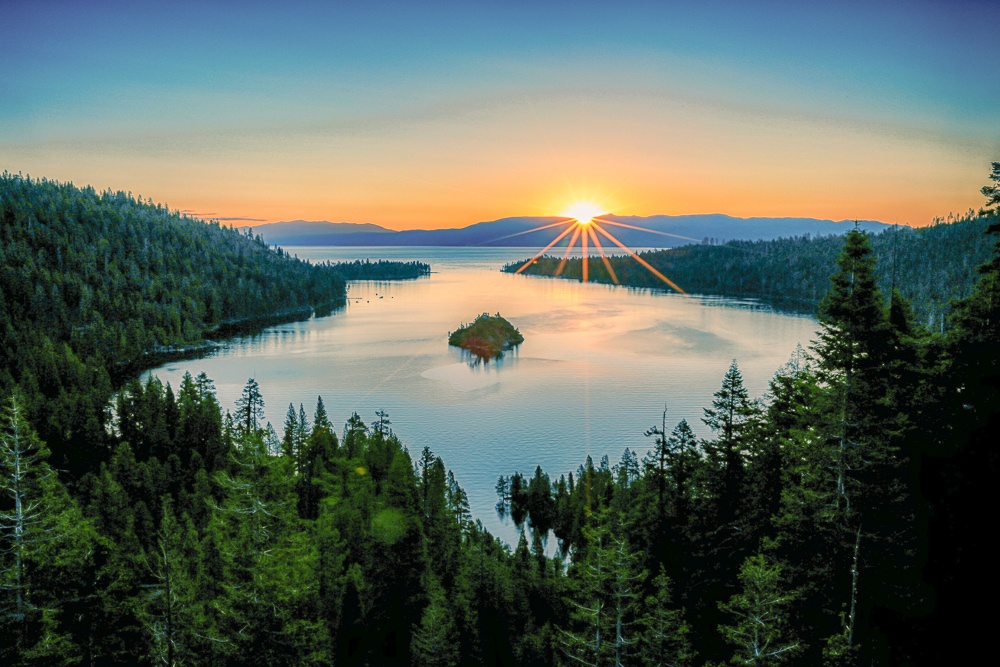
Emerald Bay · Visit Lake Tahoe ↗

THE SOLO-DRIVER PLAN

Keep moving.
Stop only to shoot.

Seven eastbound days with six hotel nights. Most days stay near six to eight hours at the wheel; Day 6 is the one 9½-hour push. Every optional photograph gets cut before rest or alertness.

7days
3,108miles
51hwheel time
16h 45mphoto time
1

Sunnyvale

2

Tahoe

3

Fallon

4

Austin / Eureka

5

Great Basin

6

Moab

7

Glenwood

8

Golden

9

Kansas City

10

St. Louis

11

Columbus

12

Baltimore

SOLO PHOTO MODE

Chase light.
Protect sleep.

Great Basin National Park describes its night skies as among the darkest in the lower 48. The Baker overnight puts the camera close to the park and gives the next morning a late start. New moon is ideal; cloud, wind, moonlight, or fatigue cancels the session.

01 · Two-hour blocksStop for 15–20 minutes every two hours. Walk, drink water, and reassess alertness before moving.

02 · US‑50 frameUse a legal turnout and telephoto lens. Never stand, park, pose, or place equipment in a live lane.

03 · Dark-sky ruleShoot 90–120 minutes, return to Baker lodging, and leave late the next morning. No white light or landscape light painting.

7 days, frame by frame.

The route finishes at 5959 Western Park Dr in Baltimore. It avoids Washington entirely and uses the western I‑68 / I‑70 approach on the final day.

DAY01

Alpine dawn to desert texture

Sunnyvale → Emerald Bay → US‑50 → Fallon

  • 04:30 · Leave Sunnyvale rested and fueled
  • 08:30–10:00 · Emerald Bay sunrise compositions
  • 10:15 · South Lake Tahoe supermarket meal + fuel
  • 11:00 · Commit east on US‑50
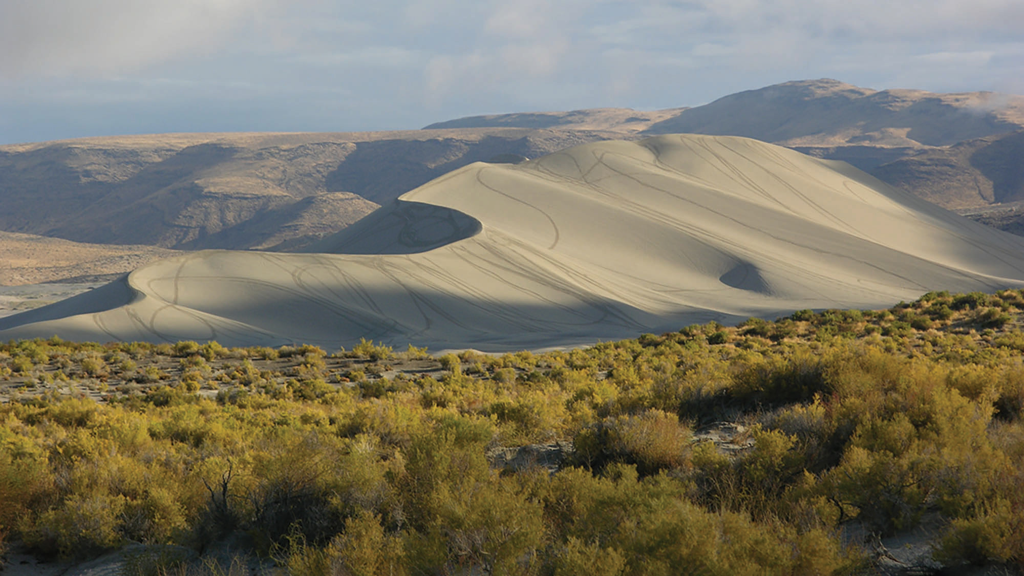
  • 15:30–16:30 · Sand Mountain long-lens frames; backtrack to Fallon
  • 17:15 · Check in, download cards, sleep early
PHOTO MISSION

Open with Tahoe layers, then compress pale dunes against the Stillwater Range. Both stops use established parking; the camera is the only reason to stop.

OVERNIGHTFallon, NV
SMART STAYBest Western Fallon Inn & Suites$140–230 est.
DAY02

The Loneliest Road under stars

Fallon → Austin → Eureka → Ely → Great Basin

  • 05:45 · Top off fuel and leave Fallon
  • 07:15 · Middlegate / US‑50 roadside details
  • 09:15–10:00 · Austin overlook and legal road frames
  • 11:30–12:15 · Eureka main street + supermarket food
  • 14:15 · Ely fuel, water, and final grocery restock
  • 16:00 · Baker check-in; nap before the night session
  • After astronomical twilight · 90–120 min Great Basin Milky Way shoot
PHOTO MISSION

Protect the empty-road telephoto frame between Austin and Eureka, then shoot the Milky Way near the Astronomy Amphitheater or Baker Archaeological Site. Run the night session only with clear skies and a favorable moon.

OVERNIGHTBaker, NV
DAY03

A late start after the dark sky

Great Basin → Spotted Wolf Canyon → Arches → Moab

  • 08:30 · Leave Baker after a full recovery sleep
  • 11:30 · Delta supermarket meal + fuel
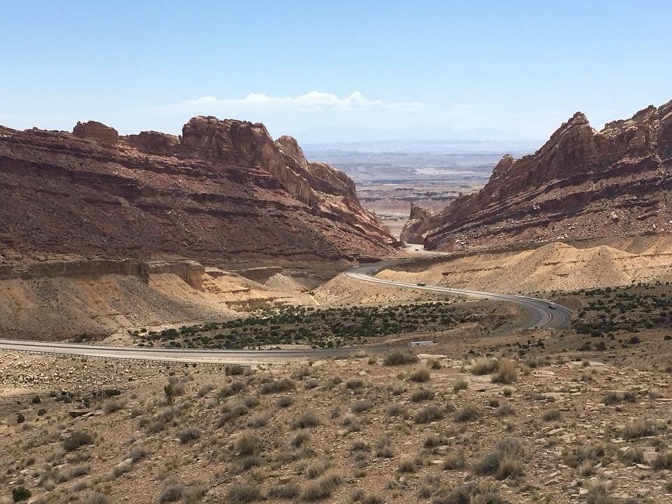
  • 14:30–15:00 · Spotted Wolf Canyon view area
  • Last 2½ hours of daylight · Arches Windows + Balanced Rock
  • 20:00 · Hyatt Place Moab check-in
  • Clock note · Utah is one hour ahead of Nevada
PHOTO MISSION

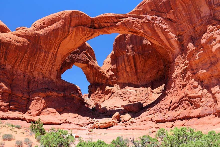
Use a telephoto to show I‑70 threading the San Rafael Swell, then keep Arches compact: Windows, Double Arch, and Balanced Rock only—no long hike or attraction checklist.

OVERNIGHTMoab, UT
SMART STAYHyatt Place Moab$160–300 est.
DAY04

Red rock to the Rockies

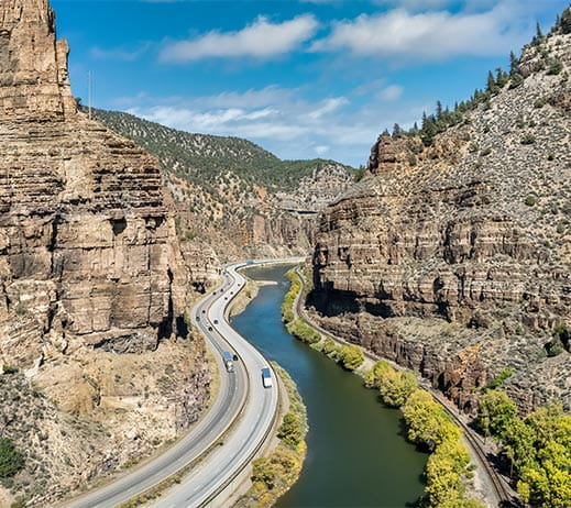
Moab → Glenwood Canyon → Red Rocks → Golden

  • 06:30–07:30 · Moab rim and Colorado River first light
  • 08:00 · Leave Moab
  • 11:45–12:15 · Glenwood Canyon rest-area frame
  • 12:30 · Supermarket meal and fuel in Glenwood Springs
  • 16:00–17:30 · Red Rocks geometry and foothill light
  • 18:00 · Denver Marriott West check-in
PHOTO MISSION

Work three quick layers: river below sandstone at Moab, highway and water inside Glenwood Canyon, then the repeating benches and monoliths at Red Rocks.

OVERNIGHTGolden, CO
SMART STAYDenver Marriott West$170–300 est.
DAY05

The long Plains day

Golden → High Plains → Kansas City

  • 05:30 · Leave Golden; start the longest western push
  • Every 2 hours · 15–20 min walk, water, and alertness check
  • 09:30 · One legal grain-elevator / open-sky frame
  • 12:30 · Supermarket meal and fuel beside I‑70
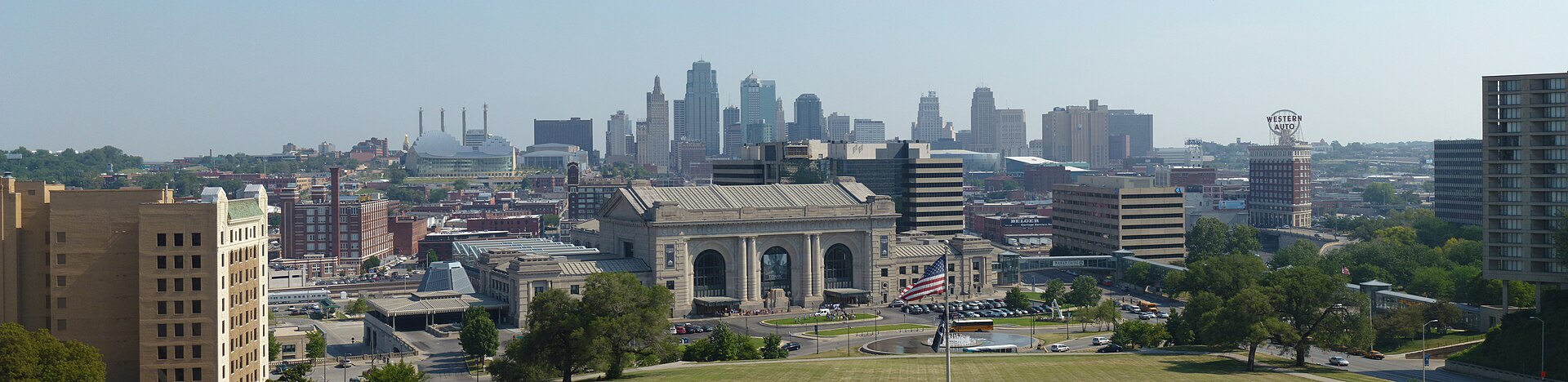
  • 17:00–18:00 · Liberty Memorial skyline at the edge of day
  • 18:20 · Hotel Kansas City check-in
  • Clock note · Kansas City is one hour ahead of Denver
PHOTO MISSION

Treat the Plains as negative space, then use the Liberty Memorial terrace to stack Union Station against downtown Kansas City. Skip the city photo if fatigue is rising.

OVERNIGHTKansas City, MO
DAY06

The one maximum-effort day

Kansas City → Gateway Arch → Columbus

  • 05:30 · Leave Kansas City fully rested
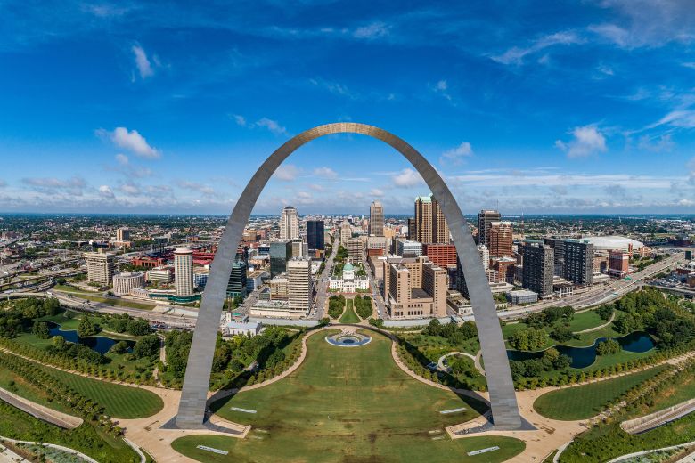
  • 09:15–10:00 · Gateway Arch exterior from the east-bank overlook
  • 12:30 · Supermarket meal, fuel, and a 20 min walk
  • Every 2 hours · Stop before fatigue, never after it arrives
  • 18:30 · Hyatt Place Columbus / OSU check-in
  • Clock note · Columbus is one hour ahead of St. Louis
PHOTO MISSION

Use Malcolm W. Martin Memorial Park for a fast skyline-and-Arch frame without a tram or museum visit. This is the hardest solo day; the photograph is optional, rest is not.

OVERNIGHTColumbus, OH
SMART STAYHyatt Place Columbus / OSU$140–240 est.
DAY07

A clean finish with no DC detour

Columbus → I‑68 → Western Park Drive, Baltimore

  • 06:30 · Leave Columbus
  • 10:30 · Fuel + supermarket meal near Morgantown
  • 13:15–13:45 · Sideling Hill road-cut photograph
  • 16:00 · Arrive at 5959 Western Park Dr, Baltimore
  • Route rule · Stay on the western I‑68 / I‑70 approach; do not route through DC
PHOTO MISSION

The final camera stop is Sideling Hill: center the folded rock layers from the legal overlook, then put the camera away and finish directly at the Baltimore address.

OVERNIGHTBaltimore, MD — finish

Six reasons to pull over.

No museums, hikes, food quests, or city wandering. Each stop earns its time through light, geometry, scale, or darkness.

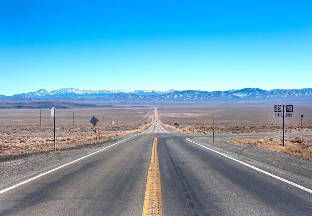
The Loneliest Road, Nevada · US‑50
Nevada · US‑50 · 2½ hours total

The Loneliest Road

Work only from signed turnouts near Austin and Eureka. A long lens makes the empty-road frame without putting you or the tripod in a live lane.

Photo: WiC Project / Pixabay
Great Basin Dark Sky, Nevada
Nevada · 90–120 minutes

Great Basin Dark Sky

The route deliberately sleeps in Baker so an exceptionally dark, moonless sky can fit without a late drive back to Ely. Skip it if cloud, wind, moonlight, or fatigue wins.

Photo: Tom Auchter / NPS
Arches in One Light Window, Utah
Utah · 2½ hours

Arches in One Light Window

Windows, Double Arch, and Balanced Rock deliver high photographic return without a long hike. Enter late for better light and lighter traffic.

Photo: Action Tour Guide
Red Rocks Geometry, Colorado
Colorado · 90 minutes

Red Rocks Geometry

Center the repeating benches, then turn around to frame the distant city between the monoliths. The Marriott is minutes away in Golden.

Photo: Advisor Travel
Gateway Arch, Fast, Missouri / Illinois
Missouri / Illinois · 45 minutes

Gateway Arch, Fast

Skip the tram. Photograph the full skyline from Malcolm W. Martin Memorial Park, then return directly to the interstate for Columbus.

Photo: Explore St. Louis
Sideling Hill, Western Maryland
Western Maryland · 30 minutes

Sideling Hill

End with the folded strata at the I‑68 road cut. The legal overlook and footbridge make this a clean final photo stop before Baltimore.

Photo: Maryland Geological Survey

Photograph highlights,
west to east.

13 frames in route order. The five marked “must get” are the keepers to protect when weather, traffic, or fatigue compresses the day.

#PhotoLocationBest lightLensThe frameMap
01
Emerald Bay, Lake Tahoe, CA
Photo: Be My Travel Muse
Emerald BayLake Tahoe, CASunrise16–35mmLayer Fannette Island beneath the granite rim and use a pine branch as foreground.
02
Sand Mountain, US‑50, NV
Photo: America the Beautiful
Sand MountainUS‑50, NVLate afternoon70–200mmCompress the pale dune against the Stillwater Range and isolate one vehicle for scale.
03
The empty-road frame, Austin → Eureka, NV
Photo: WiC Project / Pixabay
The empty-road frameAustin → Eureka, NVMust getMorning side light70–200mmFrom a legal turnout, compress the centerline into stacked basin-and-range horizons.
04
Great Basin Milky Way, Baker / Great Basin, NV
Photo: Tom Auchter / NPS
Great Basin Milky WayBaker / Great Basin, NVMust getMoonless darkness14–24mm fast primePlace the Milky Way above a clean mountain or amphitheater silhouette; no artificial light painting.
05
Spotted Wolf Canyon, San Rafael Swell, UT
Photo: Airial / contributor
Spotted Wolf CanyonSan Rafael Swell, UTSide light70–200mmCompress red-rock layers with the I‑70 ribbon threading through the geology.
06
Windows + Double Arch, Arches, UT
Photo: Full Suitcase
Windows + Double ArchArches, UTMust getLate afternoon14–24mmUse the arch as a frame and place one person near the edge for scale.
07
Balanced Rock, Arches, UT
Photo: Travel Adventures
Balanced RockArches, UTEvening side light70–200mmCompress Balanced Rock against distant fins rather than settling for the standard wide view.
08
Moab Rim + Colorado River, Moab, UT
Photo: Red Cliffs Lodge
Moab Rim + Colorado RiverMoab, UTSunrise24–70mmLayer cottonwoods, river, and sandstone rim as first light reaches the rock.
09
Glenwood Canyon, Colorado
Photo: Aspen Snowmass
Glenwood CanyonColoradoMidday24–70mmFrom a designated rest area, layer the river, elevated highway, and steep canyon walls.
10
Red Rocks Amphitheatre, Morrison, CO
Photo: Advisor Travel
Red Rocks AmphitheatreMorrison, COMust getLate afternoon24–70mmCenter the repeating benches and frame Denver between the sandstone monoliths.
11
Kansas City skyline, Kansas City, MO
Photo: Little Mountain 5 · CC BY-SA 3.0
Kansas City skylineKansas City, MOGolden / blue hour35–85mmStack Union Station and downtown from the Liberty Memorial terrace.
12
Gateway Arch skyline, East St. Louis, IL
Photo: Explore St. Louis
Gateway Arch skylineEast St. Louis, ILMust getMorning35–85mmUse the overlook to place the Arch cleanly above the river and St. Louis skyline.
13
Sideling Hill, Hancock, MD
Photo: Maryland Geological Survey
Sideling HillHancock, MDAfternoon24–70mmCenter the folded rock strata and use the road or footbridge to show scale.

Solo road-photo rule: park completely off the roadway in a legal turnout. Use the long lens for the road illusion; never enter an active lane. If a location feels exposed, isolated, or tiring, leave without the frame.

FINAL DAY · NO WASHINGTON

Finish on
Western Park Drive.

From Columbus, use the western I‑70 / I‑79 / I‑68 / I‑70 corridor. Sideling Hill is the only planned camera stop; the final destination is 5959 Western Park Dr, Baltimore.

  • 7h planned wheel time
  • 30m Sideling Hill frame
  • 4pm target arrival

A lean road budget.

The estimate covers seven days, six hotel nights, supermarket food, photo-stop fees, and arrival in Baltimore.

TRAVELER1 solo driver
HOTEL STYLE
PLANNING RANGE · 7 DAYS$1,700–$2,300≈ $1,936 midpoint before point redemptions
Fuel$500≈25 mpg at a blended $4/gal
Lodging$1,0506 nights · subtract redeemed Hyatt/Marriott stays
Groceries$196$28/day supermarket plan
Photo fees$70Arches + parking / day-use cushion
Road + parking$120Tolls, city parking, and contingency

Planning estimate in USD before hotel tax. Pack a cooler and buy breakfast, wraps, fruit, protein, water, and dinner food at supermarkets in Tahoe, Ely, Delta, Glenwood Springs, and along I‑70. Hotel cash rates are planning bands, not live quotes; trip dates are still needed for award-night and moon-phase optimization.

Three Hyatt nights.
One Marriott night.

Hyatt is used wherever it fits the route without distorting the driving days. Fallon and Baker remain local exceptions; Baker is what makes the ultra-dark sky session practical.

StopHotelWhy it worksCash estimate
Night 1 · FallonBest Western Fallon Inn & SuitesPractical local exception; protects a seven-hour first driving day$140–230
Night 2 · BakerStargazer InnBest fit for the dark-sky night; groceries on-site and no late drive to Ely$150–230
Night 3 · MoabHyatt Place MoabWORLD OF HYATTFive miles from Arches; breakfast and a direct morning exit$160–300
Night 4 · GoldenDenver Marriott WestMARRIOTT BONVOYThe requested Marriott night; close to Red Rocks and I‑70$170–300
Night 5 · Kansas CityHotel Kansas CityWORLD OF HYATTHyatt points in the center; easy eastbound departure after the skyline frame$190–320
Night 6 · ColumbusHyatt Place Columbus / OSUWORLD OF HYATTNear I‑70 / SR‑315; breakfast, parking, and a clean final departure$140–240

Award availability and points pricing vary by date. Check World of Hyatt first for Moab, Kansas City, and Columbus; use Bonvoy for the Golden night. If Hotel Kansas City is point-heavy, Hyatt Place Kansas City / Lenexa is the value fallback, but it adds a city-photo backtrack.

CHECK BEFORE DEPARTURE

Moon. Roads. Rooms.

  1. Check Great Basin stargazing guidance ↗New moon and clear, low-wind conditions are the goal. The park asks visitors to use red light and established viewing areas.
  2. Check Great Basin conditions ↗Remote services and seasonal mountain-road access are limited.
  3. Check Arches traffic ↗Late afternoon provides better photography light and can reduce crowd pressure.
  4. Build a supermarket cooler list ↗Two days of food at a time keeps the cooler light and makes rest stops predictable.

SOLO DRIVER RULES

The schedule is a ceiling.

  • Two-hour driving blocks. Take a real 15–20 minute break before continuing.
  • Day 6 is optional at full length. If alertness slips, stop overnight before Columbus and let the trip become eight days.
  • Drop photos first. A frame never outranks sleep, weather, visibility, or a safe legal stop.
  • Fuel the remote section. Fill in Fallon, Ely, and Baker; carry water and offline maps.
  • Night shoot nearby. Stay in Baker and never drive the 65 miles back to Ely after astrophotography.
Check Nevada road conditions ↗